Ohio’s National Park Service Sites
From the wilds of the Cuyahoga Valley to the field where the Wright brothers flew, here’s where you can experience America’s story.
June 2016 Issue
BY Staff & Contributors | Photo by Jeff Burcher
June 2016 Issue
BY Staff & Contributors | Photo by Jeff Burcher
Cuyahoga Valley National Park
Between Cleveland and Akron, 33,000 acres of land offer visitors a chance to relax, recharge and explore the river valley as it existed long ago.
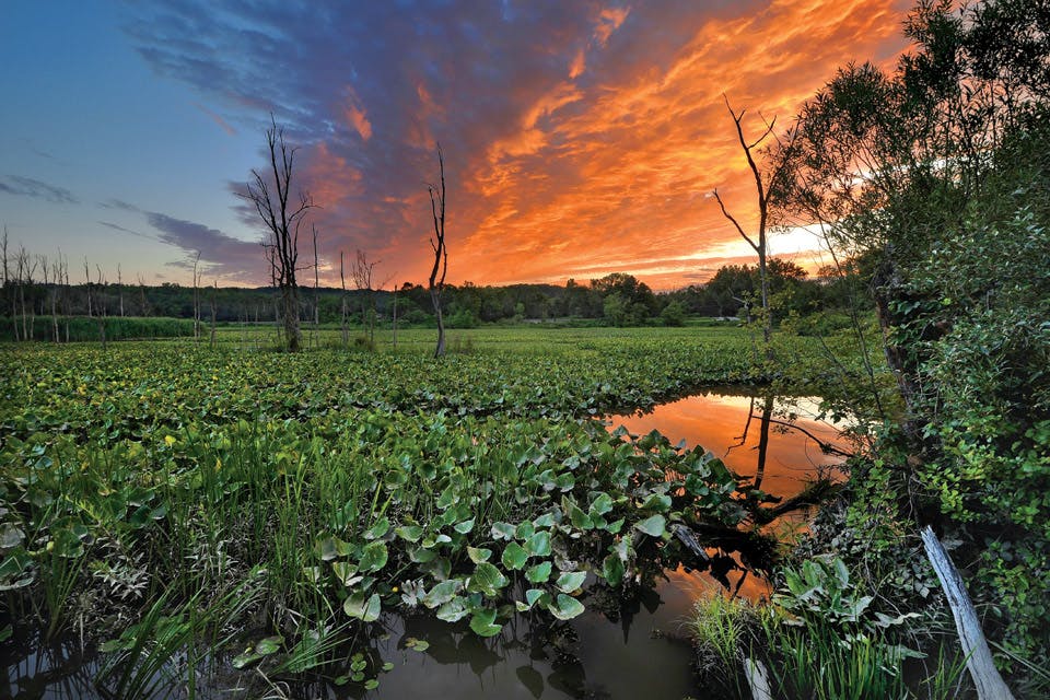
Rows of lily pads and tall willows stretch out into the distance from the boardwalk that crosses Beaver Marsh. Eagerly perched along the railing, six bird-watchers with binoculars in hand wait patiently in the hopes of spotting swallows, great blue heron or some of the more than 200 other bird species seen within Ohio’s only national park over the course of the year.
Located just 30 minutes from downtown Cleveland, the marsh’s solace is surprising and soothing. Only the light chatter of passing runners and the whistle of a distant locomotive break the stillness of the landscape.
“I think anyone that comes here is really amazed that there’s a 33,000-acre valley that’s relatively pristine, undeveloped and accessible from their front door,” says Craig Kenkel, superintendent of Cuyahoga Valley National Park. “This park has a more gentle landscape than Yellowstone or the Grand Canyon. But it’s a great environmental story with culture, recreation, farming and incredibly diverse opportunities.”
The Cuyahoga River is the constant here, flowing through forests and past farms and wetlands, which are home to more than 900 plant species, 43 fish species and 32 mammal species.
But it wasn’t always this way. Beaver Marsh, for example, was once dried-out and used as a car salvage yard. Over the years, it refilled with water, drawing beavers to the site. They built dams that increased the water level, which in turn became a catalyst for regrowth of plant life. In the 1980s, the Sierra Club cleaned up the marsh, which today has become a safe habitat for a variety of wildlife, including the majestic great blue heron, which can be spotted throughout the park as well as seen roosting in massive nests in the trees along Bath Road.
Cuyahoga Valley National Park as it is known today began when President Gerald Ford signed a bill in 1974 setting aside 16,800 acres between Cleveland and Akron as Cuyahoga Valley National Recreational Area. The protection was a step in healing the damage the area had suffered from the decline of small farming and a century of development. The Environmental Protection Agency and Clean Water Act were born of those struggles.
Those measures and the efforts of Ohio congressmen John F. Seiberling and Ralph Regula helped the Cuyahoga Valley return to its natural state. The $200 million project took 34 years and involved the restoration of nearly 100 historic structures and prominent sites, including the Ohio & Erie Canal Towpath Trail, the Frazee House (one of the earliest brick homes in the lower Cuyahoga Valley) and Beaver Marsh. In 2000, Regula pushed Congress to rededicate the Cuyahoga Valley National Recreation Area as Cuyahoga Valley National Park to make it a more recognizable part of the National Park Service.
“Our goal is for the park to be seen as an international symbol for human, urban and ecosystem renewal,” says Kenkel. “We are always trying to learn how we can continue to work with the neighbors around us to minimize impact to the watershed.”
Today, Cuyahoga Valley National Park and its 125 miles of trails exist as fertile terrain for outdoor junkies of all ages and skill levels. The park has also embraced the existence of small farms within its borders. It is currently home to nine working organic farms through the Countryside Conservancy program, an organization that aims to provide land for farmers who practice safe and sustainable methods. The highly competitive program makes use of restored wooden farmhouses and barns, which are a nod to the region’s agricultural history.
“This concept of reintroducing farming into a national park is completely unique to the rest of the country,” says Brian Reitz, development director for the Countryside Conservancy. “These farms educate how you can have sustainable agriculture in a national park. They’re set up to act in a way that if a farmer ever left, the landscape would be able to return to its wilderness environment.”
Just as the revival of local farming celebrates the area’s rich history, so do a number of independent attractions that serve as partners with the park. Hale Farm & Village — based on the farm of John Hale, one of the region’s earliest settlers — takes visitors back in time through vivid re-enactments of valley life in the 1860s. From Hale Farm and several other locations throughout the park, visitors can hop aboard the Cuyahoga Valley Scenic Railroad, which runs year-round through the heart of the valley.
But perhaps the most popular attraction in Cuyahoga Valley National Park — the image on the poster, so to speak — is Brandywine Falls, a 65-foot waterfall where Brandywine Creek crashes down over shale and sandstone. Boardwalks along the side of the gorge allow visitors to get a closer look and great photographs.
“It’s an amazing mosaic of nature,” says Kenkel, “and it is one of the most dramatic creeks in the valley.” — Andrew Poulsen
For more information, visit nps.gov/cuva.
***
Ohio & Erie Canalway National Heritage Area
Exploring the Ohio & Erie Canalway offers a look at how the nation’s first intercontinental waterway shaped U.S. history.
The Ohio & Erie Canal was once the backbone of an expanding nation. Today the natural and man-made wonders along its northern portion, which stretches 110 miles from the Lake Erie shore to New Philadelphia, offer travelers a glimpse of a time when nature was not a destination but rather the foundation upon which everyday life was built.
“Prior to building the canal, Ohio was deemed what was called a ‘frontier wilderness,’ ” says Tim Donovan, co-executive director of the Ohio & Erie Canalway National Heritage Area. “We’re taking that resource now and making it relevant again to the state.”
The options for exploration along the Canalway are plentiful thanks to an America’s Byways driving tour through four counties and 58 communities. We asked Donovan to share a few spots to get you started. — Stephanie Grauer
Zoar Village: Located near the southern end of the Canalway in Tuscarawas County, Zoar — a religious community founded by German separatists in 1817 — looks much as it did in the 19th century, with the village’s mud, stone and wood buildings still standing. “Zoar is true,” Donovan says. “It’s what was there. It’s still there.”
Canal Fulton: A quaint village with nearby mining resources during the early 1800s, Canal Fulton was important to industry in Cleveland and Akron. Today, the horse-drawn St. Helena III offers visitors an authentic canal-boat experience. “The canal was the earliest transportation network,” says Donovan. “It was actually the first transcontinental waterway transportation system in America.”
Summit Lake, Akron: Located at one of the highest points along the Ohio & Erie Canal, this lake features a floating boardwalk where the Towpath Trail meets it. “The historic canal actually had a floating boardwalk, where the mules would pull the boats across the lake,” says Donovan. “As part of the refurbished and repurposed Towpath Trail, they’ve re-created that.”
For more information about these and other sites along the Ohio & Erie Canalway, visit ohioanderiecanalway.com.
***
Hopewell Culture National Historical Park
These interesting, cryptic and highly sophisticated earthen mounds offer a glimpse into the ceremonial culture of the people who called our state home around 2,000 years ago.
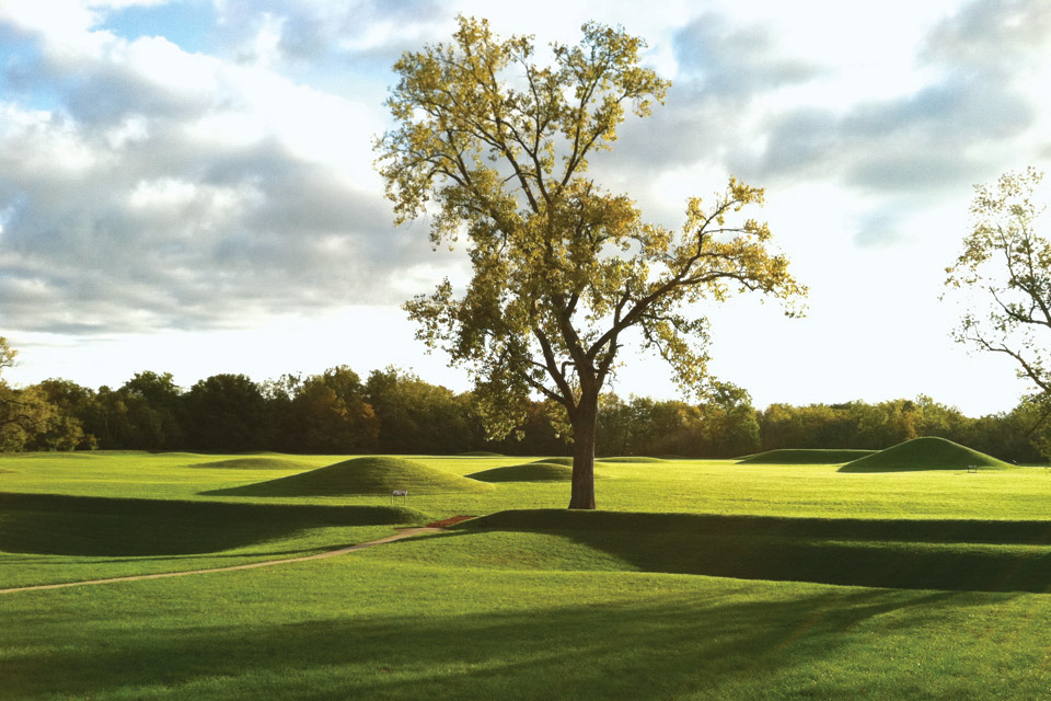
Along the Scioto River’s western bank, less than four miles north of Chillicothe, on the edge of a gentle curve, a series of mysterious earthworks rise from the landscape.
Built between 100 B.C. and 500 A.D., they are ceremonial vestiges of the indigenous Hopewell culture, one that is today remembered and shared at the Mound City Group visitor center. They are part of the Hopewell Culture National Historical Park, the largest concentration of Hopewell earthworks in existence. The historical park spans five sites (three of them currently open to the public) north and south of Chillicothe, but their significance wasn’t always recognized.
During the War of 1812, the Civil War and, most notably, World War I, the Mound City Group site was home to Camp Bull, Camp Logan and Camp Sherman, respectively. It wasn’t until 1923, when Ohio-born President Warren G. Harding established the former Mound City Group National Monument, that these prehistoric treasures were preserved.
Today, the Mound City Group — a 13-acre rectangular earthen structure, featuring walls that are 3-to-4-feet high and gateways on the east and west sides — is the only fully restored Hopewell earthwork complex in existence.
In 1980, Congress added the nearby Hopeton Earthworks to the monument, and in 1992 Hopewell Culture National Historical Park was established, expanding Hopeton Earthworks and annexing three other sites in the region: High Bank Works, Hopewell Mound Group and Seip Earthworks.
“They are precise, they are geometric and they are primarily ceremonial. They were, perhaps, the centerpiece of this culture’s social life,” says Susan Knisley, a ranger at Hopewell Culture National Historical Park. “If you look at outlines of the earthen walls, some of them have spaces where the moon will rise or set on the horizon during its 18.6-year cycle. They watched and aligned their earthworks with this cycle.”
When the air is cooler than the earth, a dense fog slowly rises above the earthworks, adding an aura of mystique. And while many of the Hopewell peoples’ secrets will forever remain buried, Hopewell Culture National Historical Park continually seeks to understand who they were.
Named after former property owner Mordecai C. Hopewell, the 300-acre Hopewell Mound Group has become the primary site for studying the culture that flourished in the Midwest and northeast United States, primarily along river banks, between 100 B.C. and 500 A.D. Although the mounds have changed a great deal, especially in the last two centuries, a set of maps in Ephraim G. Squier and Edwin H. Davis’ famous 1848 book, Ancient Monuments of the Mississippi Valley (the Smithsonian Institution’s first publication), have aided archaeologists in understanding and re-establishing these sacred structures.
“Ross County is the birthplace of modern-day archaeology,” says Melinda Repko, a ranger at Hopewell Culture National Historical Park. “A lot of archaeological techniques were first established at these Hopewell culture sites.”
The parallelogram-shaped Hopewell Mound Group is one of the three sites open to visitors. It features a 2.5-mile interpretive trail, along with a stretch of the multi-use Tri-County Triangle Trail. Archaeologists estimate the site’s walls, which are 1,800 feet by 2,500 feet in length, once measured 35 feet wide and enclosed an area of 111 acres.
Located about 17 miles west of the Mound City Group visitor center, Seip Earthworks is the historical park’s third public site. It is composed of three shapes that intersect to form a cryptic ceremonial pattern. Researchers estimate that the large elliptical mound at its center was once 240 feet long, 160 feet wide and 30 feet high.
“Because of early archaeological practices, Seip was excavated and put back together again,” explains Knisley. “Due to 200 years of agriculture, a lot of these sites have diminished as well. But archaeologists are now using remote sensing instruments to determine the footprint of the area, and they can do this without removing dirt.”
Located about 3.8 miles east of the Mound City Group visitor center, Hopeton Earthworks is home to a square earthen enclosure that measures roughly 900 feet on each side connected to a circle 1,050 feet in diameter. Smaller circular earthworks abut the square. At its northwest corner, parallel walls stretch toward the Scioto River. Although this site is not yet open to the public, park officials hope to have it ready for visitors later this summer.
Due to the mounds’ significance in telling the story of our state, nation and world, the United Nations Educational, Scientific and Cultural Organization has nominated the Hopewell Culture National Historical Park, along with the Newark Earthworks and Fort Ancient Earthworks, to become a World Heritage Site.
“It feels like it is going to happen, but it is still a couple years down the road,” says Knisley. “It would be an amazing thing for these endangered sites — world centers for these early people. You don’t see these anywhere in the world outside of Ohio.” — Leo DeLuca
For more information and specific directions to these sites, visit nps.gov/hocu.
***
North Country National Scenic Trail
This hiking route that snakes through seven states including Ohio provides a closer look at some of our state’s most beautiful scenery.
Created in 1980, the North Country National Scenic Trail covers 4,600 miles as it travels through seven northern states. The 1,000-mile Ohio portion of the route starts on the state’s eastern border, not far from Beaver Creek State Park, and runs southwest until it merges with the Buckeye Trail just outside of Zoar. It then winds through southern Ohio before heading north again until it enters Michigan west of Toledo. The trail travels through Wayne National Forest and Hocking Hills State Park, but it also touches more than 100 towns. Deciding on where to start exploring can be daunting. Buckeye Trail Association executive director Andrew Bashaw offers a few suggestions. — Alyssa Nieset
Milford, Ohio: The first official Buckeye Trail Town, this southwest Ohio city offers hikers a place to stop and explore. “They have a quintessential historic district next to the Little Miami River,” says Bashaw. “It’s a great place for long-distance hikers to resupply or to begin as a base.”
Shawnee State Forest: Fourteen miles of the North Country Trail follow the hilly and strenuous Shawnee State Forest backpacking loop. “[This section] is some of the most, if not the most, rugged part of the trail, because this part has the greatest elevation changes in the state,” says Bashaw.
Hocking Hills State Park: This section of the trail passes by some of Ohio’s most famous natural wonders: Ash Cave, Old Man’s Cave and Cedar Falls — all located just three miles from one another. “It’s probably the most popular trail in Ohio,” says Bashaw.
For more information, visit nps.gov/noco.
***
Charles Young Buffalo Soldiers National Monument
This historic home in Wilberforce is the newest addition to Ohio’s National Park Service sites.
Charles Young lived in the southwest Ohio community of Wilberforce from 1894 until 1898, teaching military sciences and tactics at Wilberforce College. “He enjoyed his time there and referred to it fondly throughout his career when he traveled,” says Michael Johnson, the Midwest region public affairs officer for the National Park Service. Young’s military career began at West Point, where he was the third African-American to graduate from the United States Military Academy. In the Army, he rose to the rank of colonel and inspired a new generation of military leaders. Young’s home in Wilberforce was preserved as a national monument in 2013. It is not yet open daily, although open houses and programs are hosted at the site. 1120 U.S. 42 E., Wilberforce 45384, nps.gov/chyo. — Carolyn Pippin
***
Dayton Aviation Heritage National Historical Park
The story of the Wright brothers and their friend and acclaimed poet Paul Laurence Dunbar are celebrated at these destinations that trace their lives and accomplishments.
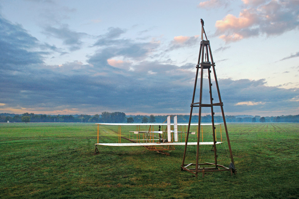
Calming winds blow across the prairie where Wilbur Wright first flew for more than 39 minutes and 24 miles — so long he ran out of fuel. Here, secluded on this mysterious field outside Dayton, he and his brother Orville uncovered the secrets of the birds.
But the story of their successes at Huffman Prairie began in West Dayton’s historic Wright-Dunbar neighborhood — a place that today scantly resembles its turn-of-the-century appearance. Nineteenth century buildings rest alongside modern storefronts, and the rumble of automobiles has long replaced the click-clack of horse hooves on unpaved roads.
But it was here that Wilbur and Orville Wright lived, worked and invented the world’s first airplane. Orville’s friend and high school classmate Paul Laurence Dunbar, the first internationally acclaimed African-American poet, resided just down the road. The historic neighborhood is also where the Dayton Aviation Heritage National Historical Park begins. The Wright-Dunbar Interpretive Center and the Aviation Trail visitor center located at 16 S. Williams St. feature extensive exhibits on both the Wright brothers and Dunbar. Adjacent to the visitor centers is the circa 1896 Wright Cycle Co. — one of five bicycle shops the Wright brothers owned over the years.
In 1992, President George H.W. Bush signed the Dayton Aviation Heritage Preservation Act that, among other things, established Dayton Aviation Heritage National Historical Park to help the city share the story of the Wright brothers and Dunbar with the world.
“[It] was one of the first national parks designed as a public and private sector partnership, meaning that some sites are privately owned and operated,” explains Alex Heckman, director of education and museum operations at Dayton History, which helps preserve half of the Dayton Aviation Heritage National Historical Park sites.
About a 15-minute walk from the Wright Cycle Co. sits the Paul Laurence Dunbar House Historic Site — a late 1880s Italianate-style home Dunbar purchased for his mother, Matilda, in 1904. Two years later, on Feb. 9, 1906, at the age of 33, Dunbar died from complications brought on by tuberculosis.
Dunbar’s poetry had a profound impact on many renowned writers to follow, including Maya Angelou, who named her 1969 autobiography I Know Why the Caged Bird Sings from a line in Dunbar’s poem “Sympathy.”
“He had a huge influence on Langston Hughes, who came to Dayton and the Dunbar House in the 1940s,” says Margaret E. Peters, president emeritus of the Paul Laurence Dunbar Branch of the Association for the Study of African-American Life and History. “Most people love Langston Hughes, but they haven’t the vaguest idea that Dunbar influenced him.”
Up West Third Street, less than 2 miles from the Dunbar House, sits the Wright Company Factory. Opened in 1910, it was the first building in the U.S. specifically constructed to manufacture airplanes, but as the newest addition to the park, it is not yet open to the public.
From the former factory, Carillon Historical Park’s Wright Brothers Aviation Center is less than 3 miles away, situated on a 65-acre campus. With more Wright brothers artifacts on display than any place in the world, the facility centers around the 1905 Wright Flyer III: the first practical flying machine and the only airplane designated a National Historic Landmark.
“It was Orville’s particular contribution to have the airplane sitting in a pit, about 4 1/2 feet below where guests stand around the perimeter of the plane,” says Heckman. “He wanted to present this aircraft ... in a way that would allow people to be ... almost within reach of the plane.”
About 2 miles east of Carillon Historical Park sits Hawthorn Hill. Finished in 1914, the hilltop residence was the home of Orville Wright, his younger sister, Katharine, and their elderly father, Bishop Milton Wright. While Wilbur had a hand in the mansion’s plans, he died of typhoid fever in 1912. Orville lived at Hawthorn Hill from 1914 until he died of a heart attack in 1948.
Huffman Prairie Flying Field, an 84-acre former cow pasture northeast of Dayton, and its interpretive center are the Dayton Aviation Heritage National Historical Park’s last stops. At Kitty Hawk, North Carolina, the Wrights made four flights all lasting less than one minute each. It wasn’t until they returned home to Dayton and Huffman Prairie that they built the world’s first practical airplane.
“When asked to use his cow pasture as a flying field, Torrence Huffman, a West Dayton banker and an acquaintance of the Wright brothers, required no rental fee,” says Heckman. “[He] simply asked that the brothers corral the cows and horses, so they would be safely away from the flying zone.” — LD
For more information, visit nps.gov/daav.
***
National Aviation Heritage Area
The attractions in this eight-county region continue the story the Wright brothers started.
The Wright brothers lived, worked and were laid to rest in their hometown of Dayton. Ever since then, southwest Ohio has been the backdrop for their brilliant invention as well as its evolution into larger, powerful and more complex machines. The National Aviation Heritage Area spans eight counties and includes more than a dozen sites for visitors to explore. These three destinations offer a flavor of the story of flight being told here that has made the region an epicenter of aviation history. — LD
Historic WACO Airfield & Museum, Troy: Around 1930, the WACO Aircraft Co. was the largest manufacturer of civil aircraft in the nation. This 77-acre site includes a 2,200-foot runway, learning center and museum. “There is a WACO flight simulator, a theater inside a replica WACO glider, seven aircraft on display and factory memorabilia,” says executive director Gretchen Hawk.
Champaign Aviation Museum, Urbana: Located at historic Grimes Field, the Champaign Aviation Museum is dedicated to the preservation of World War II aircraft. “We have visitors travel from all over the world to see our B-17 Flying Fortress,” says executive director Dave Shiffer. “We are restoring it with volunteers who travel from as far away as England.”
Armstrong Air & Space Museum, Wapakoneta: On July 20, 1969, Wapakoneta native Neil Armstrong became the first man to walk on the moon. Resembling a futuristic moon base, the Armstrong Air & Space Museum features many Armstrong artifacts, including two of his spacesuits. “We celebrate the time before the space race to the space race itself to the shuttle missions to developments happening today,” says director of programming and education Christopher Moynihan.
For more information about these and other sites within the National Aviation Heritage Area, visit nps.gov/avia or aviationheritagearea.org.
***
David Berger National Memorial
A steel sculpture memorializes the Ohio native and 10 other Israeli athletes killed during the 1972 Olympics.
Standing nearly 14 feet high, the David Berger National Memorial depicts five Olympic rings broken in half, symbolizing the terrorist attack at the 1972 Olympics in Munich. David E. Davis created the 6,000-pound steel alloy sculpture in 1975 to honor Shaker Heights native and Israeli weightlifter David Berger and the 10 other athletes who lost their lives. There is an upward motion in the broken rings meant to suggest the peaceful intent of the Olympics and a search for understanding and hope. “The world was, and is, horrified by the massacre at the 20th Olympiad, yet the tragedy of David’s and the other athletes’ deaths should not be in vain,” says Debra Posner, chief marketing and membership officer at the Mandel Jewish Community Center in Beachwood where the sculpture is located. 26001 S. Woodland Rd., Beachwood 44122, nps.gov/dabe — Kelsey Smith
***
Perry’s Victory and International Peace Memorial
The 352-foot-tall Doric column rising from South Bass Island pays tribute to Commodore Oliver Hazard Perry and offers visitors a view of Lake Erie unlike any they’ve seen before.
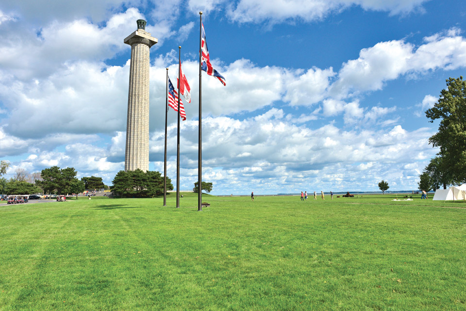
On a clear day at the top of Perry’s Victory and International Peace Memorial, you can see each of the Lake Erie Islands, including the ones in nearby Canada. The observation deck is too high to hear noise from the streets of Put-in-Bay below, and the tourists seem to move in silence. Lake Erie appears even more massive from this height. It is peaceful and impressive.
Not far from here on a September day in 1813, Commodore Oliver Hazard Perry led the United States to one of the most pivotal victories in the War of 1812: the Battle of Lake Erie. After the battle, which gave the United States control of the strategically important waters of Lake Erie, Perry wrote the famous words, “We have met the enemy and they are ours” to Gen. William Henry Harrison
The monument that commemorates that accomplishment was built between 1912 and 1915 to both honor Perry’s achievement and celebrate the lasting peace between the United States, Great Britain and Canada. American and British soldiers are buried beneath the monument’s marble floor, and visitors can pay their respects before ascending the structure.
The 352-foot Doric column is the third-tallest monument in the National Park Service (only the Washington Monument and the Gateway Arch in St. Louis are taller) and the most iconic feature of South Bass Island.
“Having this massive structure roughly 30 floors tall out here ... where everything is flat with the water, you can see it from miles away,” says park ranger Robert Whitman.
The monument is the biggest attraction on the island, according to Maggie Beckford, the recently retired director of the Put-in-Bay Chamber of Commerce. She will be working as a park ranger at the site this summer.
“It’s very popular for how small the park is, and it’s on an island,” Beckford says.
In 2015, more than 150,000 people went to the top of the monument, and that count doesn’t include those who just stopped at the visitor center or took park in one of the interpretive programs held at the 25-acre site. High attendance numbers are expected at the monument this year, given the National Park Service centennial.
It may also be your last chance to visit the observation deck for a while. It will likely be closed in 2017 (the visitor center will remain open) so the park service can make additional repairs to the memorial. The monument was previously closed for nearly three years between 2009 and 2012 for $7 million worth of renovations.
“There’s only a handful of War of 1812 sites. Each time period is slightly different,” says Whitman, who takes part in the re-enactments staged at the memorial. “We show the steps of what they would have done firing arms, in particular the army on land, how they would have done things, just so people can experience it.” — Kristina Smith
For more information, visit nps.gov/pevi.
***
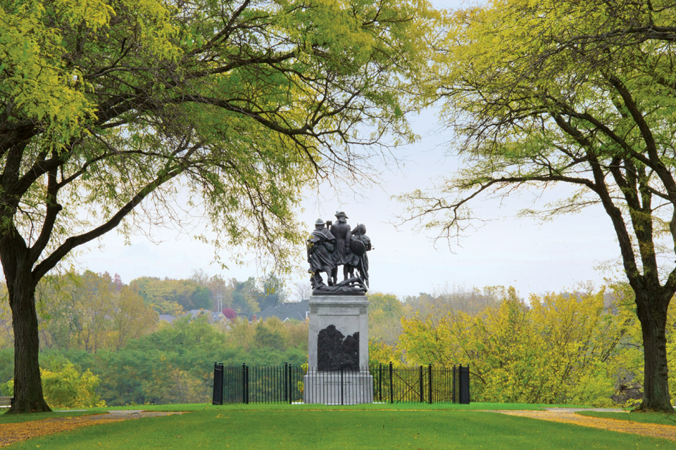
Fallen Timbers Battlefield and Fort Miamis
These two northwest Ohio sites tied to our nation’s westward expansion offer places for exploration and reflection.
The events that took place in what is today the city of Maumee during the Battle of Fallen Timbers were vital to establishing the Northwest Territory and marked a turning point in the history of our then-young nation. Now preserved as a national historic site, Fallen Timbers Battlefield and the remnants of Fort Miamis located 5 miles to the east of it allow visitors to walk the grounds where the United States began its push west.
Fallen Timbers Battlefield: The 187 acres where the Battle of Fallen Timbers was waged is today an open meadow with a small wooded area at its heart. On Aug. 20, 1794, Maj. Gen. Anthony Wayne led the U.S. Army in a fight for control of the region, paving the way for Ohio’s statehood in 1803. “Ohio was contested land between settlers pushing over and the Native American tribes that had been using the land for generations,” says Shannon DeYoung, manager of park programming interpretation for the Metroparks of the Toledo Area, which manages the site for the National Park Service.
Fort Miamis: Even after America won its independence, British forces remained on American soil until the U.S. lived up to its portion of the 1783 Treaty of Paris, which included the repayment of debts. British soldiers built Fort Miamis in 1794 to protect England’s interests in the area. “[It] was an important defensive position for the British due to its location on the Maumee River and its proximity to the U.S.-occupied Fort Meigs,” explains DeYoung. Today, Fort Miamis no longer stands, but hilly earthworks that were part of it are still visible from a walking path. — Kelsey Smith
For more information about Fallen Timbers Battlefield and Fort Miamis, visit nps.gov/fati or metroparkstoledo.com.
***
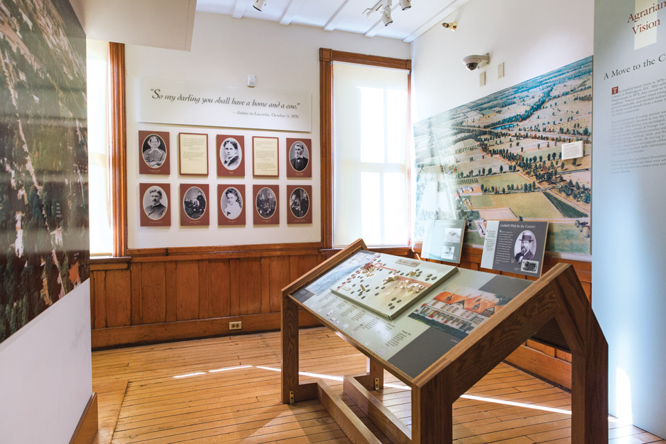
Presidential Paths
Visit the homes were William Howard Taft grew up and James A. Garfield delivered his front-porch campaign, as well as the Canton site dedicated to our nation’s first ladies.
Ohio claims eight of the men who have held our nation’s top office, and two of their former homes are overseen by the National Park Service. The agency is also affiliated with the First Ladies National Historic Site, two Canton properties that celebrate the contributions of presidential spouses. — CP
James A. Garfield National Historic Site: Take a guided tour of James A. Garfield’s Mentor home and stand on the porch where he delivered his campaign speeches. Thousands of items are on display within the home, with 80 to 85 percent of them original to the Garfield family. “When people come here, they are seeing a complete presidential collection,” says site manager Todd Arrington. nps.gov/jaga
William Howard Taft National Historic Site: The tour through the Cincinnati home where William Howard Taft was raised offers a glimpse into the upbringing of the only man to ever hold the positions of president and chief justice of the United States. “[The Tafts were] an influential family, and they believed in hard work, fairness, a good education and public service,” says Kerry Wood, chief of interpretation, education and operations. nps.gov/wiho
First Ladies National Historic Site: The Saxton McKinley House, where Ida Saxton McKinley grew up and she and William McKinley lived for a time, now houses a museum. The nearby City National Bank Building is home to the National First Ladies’ Library. Both sites tell the stories of our nation’s first ladies. “People really think of them as social people, like planning state dinners,” says Patricia Krider, executive director of the library’s education and research center. “But in reality, first ladies have been very successful in promoting causes and making change.” nps.gov/fila
Photo Credits: Hopewell: National Park Service; Huffman Prairie: Timothy R. Gaffney; Perry’s Victory and International Peace Memorial: OSP Images; Fallen Timbers: Metroparks Toledo; James A. Garfield National Historic Site: Maureen McGregor
Related Articles

11 Summer Stops in Akron and Summit County
With a great mix of downtown attractions and nature to explore, the Rubber City and the area surrounding it offer plenty of summer fun for the family. READ MORE >>
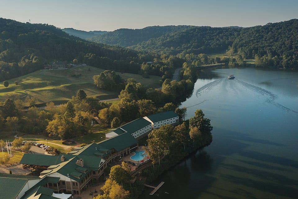
4 West Virginia Resorts to Stay at this Summer
These four Mountain State destinations help travelers embrace the outdoors, whether you want to enjoy a day on the lake, play a round of golf or take on rushing whitewater. READ MORE >>
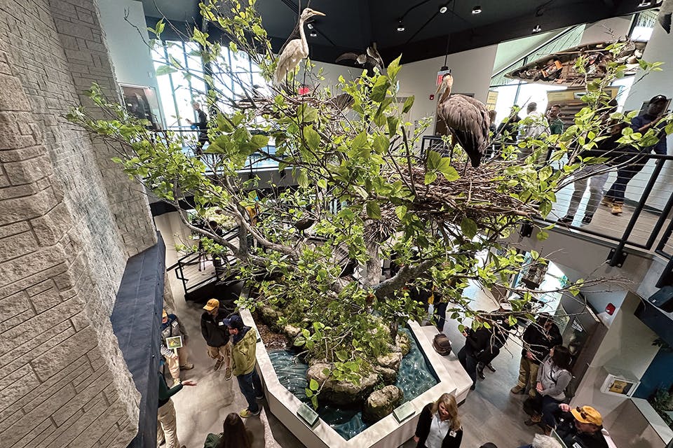
Step Inside the Revamped Magee Marsh Visitor Center
The makeover of the former Sportsmen’s Migratory Bird Center provides outdoor lovers a fresh look at our state’s prized bird-watching destination. READ MORE >>


