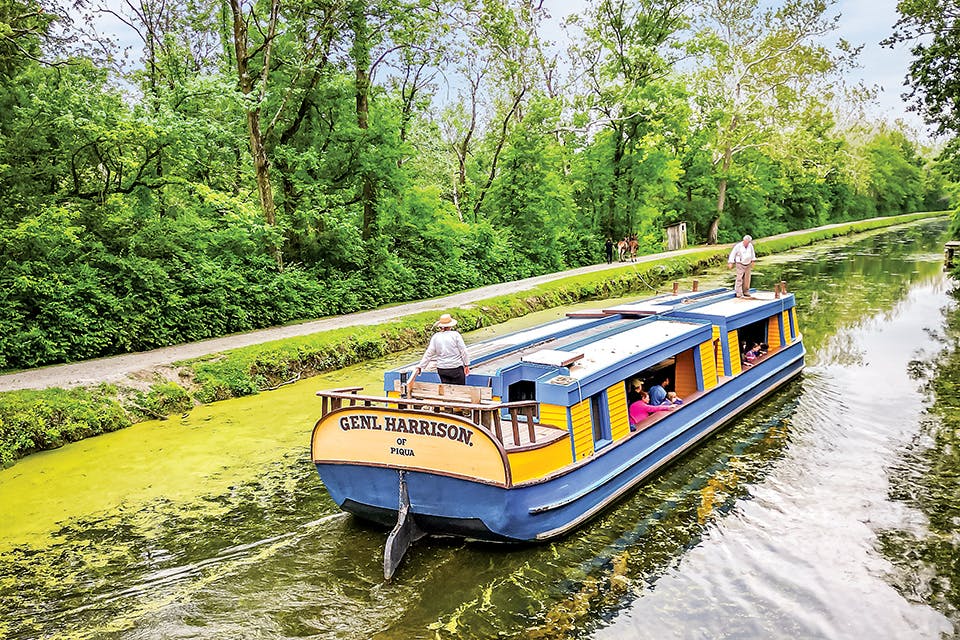
General Harrison canal boat on Miami & Erie Canal in Piqua (photo courtesy of Johnston Farm and Indian Agency)
Travel

4 Ohio Scenic Byways to Explore this Summer

From a route that follows the path of the Miami & Erie Canal to one that highlights the hometown of a national hero, these treks promise a drive through history.

Miami & Erie Canal 

Following the route that mule-drawn canal boats once traveled to transport cargo, the Miami & Erie Canal was key to Ohio’s growth in the 1800s. Once railroads became king, using the canal as a means of transportation ended. Today, the Miami & Erie Canal Byway along state Route 66 follows a 54-mile stretch of the historic waterway.

Head just 15 minutes north and you’ll find the Johnston Farm and Indian Agency, where you can ride in the General Harrison canal boat, a 70-foot craft pulled by mules that gives a flavor of what life was like here in the 19th century.

“As you’re driving along state Route 66, you can look off to the side of the road and see most of the canal system and a lot of its historical structures,” says Steve Dorsten, trustee and secretary of the Miami & Erie Canal Corridor Association “A lot of them are still intact.”

North of Piqua sits Lake Loramie State Park in Minster, where over 8 miles of trails wind along the lake and through the wooded terrain before leading to the village of New Bremen, which is home to the New Bremen Bicycle Museum of America. The museum showcases how bicycles have changed over time, beginning with wooden models in the 1800s.  

Grand Lake St. Marys State Park also sits along the byway and is home to public swimming beaches, a campground and boat launches. One of the last stops on the byway is the Delphos Canal Commission Museum. Its three floors tell the story of both the town of Delphos and the Miami & Erie Canal and features artifacts like the recovered remains of the Marguerite canal boat. 

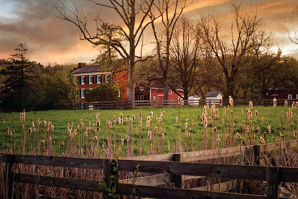
Hale Farm and Village along the Heritage Corridors of Bath byway (photo by Nancy Balluck)
Heritage Corridors of Bath 

Spanning the entirety of Bath Township in Summit County, this 39-mile byway tells the story of the area’s foundations in the 19th century. With just 15 points of interest along the way, the route is a perfect trip to take with the family and offers opportunities to explore both history and nature. 

Hale Farm and Village is a favorite attraction along the byway and offers living-history experiences that provide travelers a glimpse into the past. Learn about trades like glassblowing, blacksmithing and pottery, and see farm animals. The property sits in the township’s northeast corner, and within the boundaries of Cuyahoga Valley National Park. In 1974, the land for Ohio’s only national park was set aside by the federal government as Cuyahoga Valley National Recreation Area, and today, there are dozens of miles of hiking and biking trails within its 33,000 acres.

On the southern end of the driving route, visit the Bath Township Museum, which is housed within the historic town hall, as well as the Thomas Pierson House and Octagon Bee House. Pierson’s 1837 home now houses a bakery, while the adjacent structure he built two years later for his honeybees still stands.   

The Crown Point Ecology Center along the byway hosts summertime science and farm camps for kids and it has a community-supported agriculture program that allows locals to become shareholders.

While driving this route, keep an eye out for the historic barns at Crown Point, Hale Farm, the Hammond-Cranz Homestead and more. They are part of the Barns of Bath trail set to be launched in June 2024, and there are more than 60 such historic structures throughout the township.

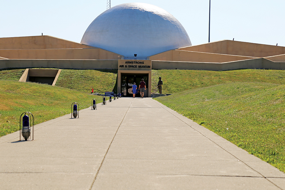
Exterior of Armstrong Air and Space Museum in Wapakoneta (photo courtesy of Grand Lake Region Visitors Center)
Neil Armstrong Scenic Byway 

On Sept. 6, 1969, Neil Armstrong arrived in his hometown of Wapakoneta nearly two months after his triumphant return from the Apollo 11 mission, during which he became the first man to walk on the moon. Now, his 4-mile homecoming parade route is memorialized as part of the 10.9-mile Neil Armstrong Scenic Byway. It is one of  the newer Ohio scenic byways, established in 2019 to commemorate the 50th anniversary of the moon landing.

Start the trip east of downtown Wapakoneta at the Armstrong Air and Space Museum, which has interactive exhibits for both kids and parents, as well as artifacts from Armstrong’s life and the Apollo 11 mission. Heading west into town, 21 stops in the city mark places important to Armstrong’s life.

“We feel very fortunate that we have so many historic buildings that are places Neil and his family members worked or went to recreate,” says Donna Grube, executive director of the Grand Lake Region Visitors Center, “like the movie theater and the building where he worked in the drugstore to earn the money for his flying lessons.”

Many spots around town existed when Armstrong and his family lived here, including the Wapa Theatre, a movie house with a dazzling marquee that still draws in audiences to see new-release films.

A 1-mile riverwalk path follows the route of the Auglaize River, while the city’s Historic Homes District highlights Wapakoneta’s most architecturally significant homes. Make sure to hit the 23rd stop on the route, the Armstrong Boyhood Home. Although 601 W. Benton St. is a private residence today, travelers can still view the exterior of the home where Armstrong lived during his teenage years. 

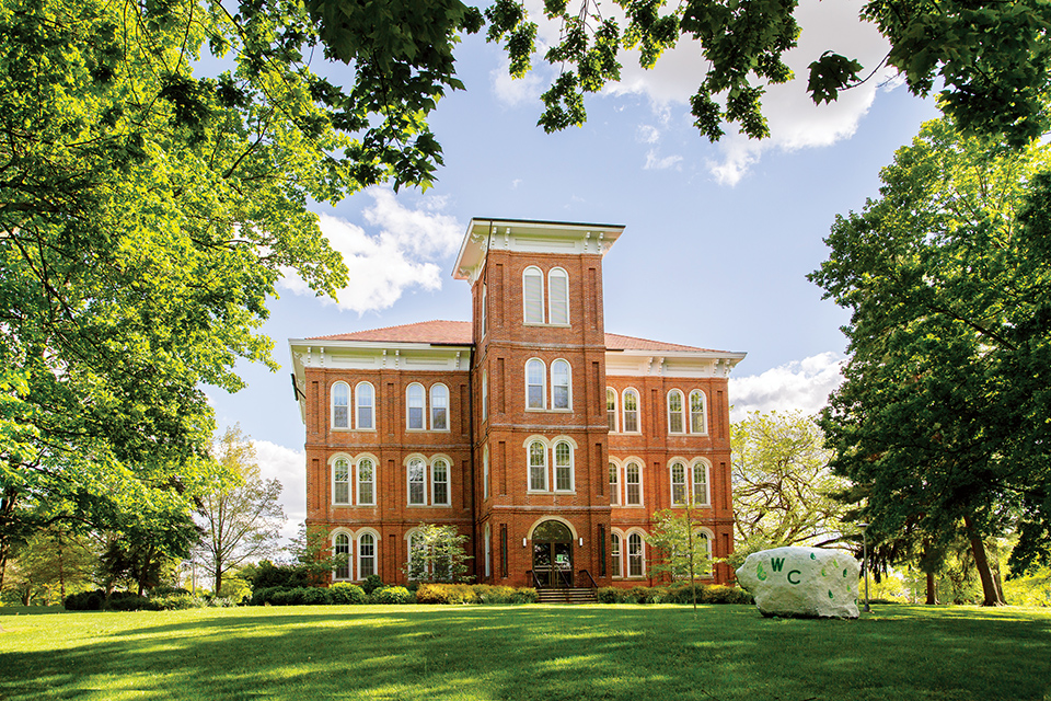
Exterior of building at Wilmington College on Quaker Scenic Byway (photo courtesy of Quaker Heritage Center)
Quaker Scenic Byway 

At one point, the largest population of Quakers in America were found in Clinton County. Those who belonged to the peaceful religion, which is an Anabaptist branch of Christianity, were instrumental in Ohio’s underground railroad and moving southerners who were enslaved to freedom in the north.

Quaker meeting houses were places where members could come together and practice the SPICES Principles — simplicity, peace, integrity, community, equality and stewardship — and today, those same meeting houses are still found along the Quaker Scenic Byway.

Following a 54-mile loop that begins and ends at Wilmington College, the byway circles through Wilmington and Waynesville. Along the route, travelers will find sites such as Wilmington College’s Quaker Heritage Center, which details the history of Quakerism in the region. Quaker meeting houses along the route include the Wilmington Friends Meeting House and Dover Friends Meeting House and Burial Ground, where worship services still take place today.

Stop off to explore nature at Caesar Creek State Park. The park has hiking trails, a swimming beach, a nature center with a museum and boat launches. The neighboring Caesar’s Creek Pioneer Village cares for preserved 19th-century cabins.

From there the byway enters Waynesville and its downtown, which is home to local shops and restaurants as well as the Sauerkraut Festival held each October. Continuing into the village of Clarksville, the byway passes by That Guy’s Family Farm, which is run by the local Ashmore family and sells fresh vegetables and flowers. As the road returns to Wilmington, travelers can book an appointment to visit the Clinton County Historical Society and Museum to learn more about the area’s founding.  

For more information along these routes, visit ohiobyways.com.

---

Explore More
Those interested in checking out more of our state’s 27 scenic byways can visit ohiobyways.com. Here are a few route recommendations to get you started. 

History & Heritage
Stretching 120 miles from Clarington to Nelsonville, the Appalachian Scenic Byway explores the beauty of this southeast Ohio region known for its coal heritage. The Johnny Appleseed Historic Byway runs from Loudonville to Mansfield and follows the 30-mile route that its namesake traveled in the 19th century. The 110-mile Ohio & Erie Canalway stretches from Cleveland to Tuscarawas County as it traces the historic canal route.  

Water & Woods 
The 26.4-mile Hocking Hills Scenic Byway follows portions of state Routes 374, 665 and 56 and passes by some of the region’s most notable natural formations, including Old Man’s Cave and Ash Cave. The 293-mile Lake Erie Coastal Ohio Trail follows our state’s shoreline from one end to the other, while the 452-mile Ohio River Scenic Byway traces the route of the Ohio River from East Liverpool to Cincinnati. 

Town & Country 
Spanning 160 miles, the Amish Country Byway winds through the rolling hills of this northeast Ohio region known for its simplicity and tranquility, while a drive on Licking County’s 10-mile Granville Scenic Byway offers both small-town attractions and rural countryside. Drover’s Trail Scenic Byway along state Routes 800 and 147 follows the 37-mile route from Bellaire to Hendrysburg that cattle drovers used to bring their livestock to market.