16 Autumn Hikes in Ohio
We asked seasoned hikers throughout Ohio to share what makes some of their favorite trails so special.
October 2014 Issue
BY Kara Kissell | Photo by Carl Scheiner
October 2014 Issue
BY Kara Kissell | Photo by Carl Scheiner
Scout Trail | Oak Openings Preserve | 16-mile loop As co-organizer of the Toledo Hikers, Bikers, Paddlers and Other Adventurers, Ken Mennell enjoys showing off places such as northwest Ohio’s Oak Openings Preserve. “New people who we bring along say, ‘I’ve lived here forever and I never knew this was here,’ ” he says. “And I say, ‘Well, this is why we do it.’ ”
I moved out here for work about 10 years ago. I didn’t know anyone, so I joined this hiking group to meet people. I’ve been leading the hikes for maybe eight years … going out and learning new stuff, learning the history.
Hiking is cheap. You just throw on a pair of shoes and get out there. … There is something about having respect for the environment and just the peace and quiet of being out with the trees and the sun and the fresh air.
I love hiking the Oak Openings because you never know what you are going to run into, whether it’s turkeys or deer or squirrels. Last week, they just had a sighting of badgers moving back to the area. Along the Scout Trail … there is such a variety of trees [and] you get all the different color combinations. Even the poison ivy turns bright red and yellow so the vines going up the trees are all big and bright. Because the vines are thumb-thick, everyone [says], “Oh, look!” and I say, “No, no stay away!” It looks nice, but it’s still poison ivy.
About every quarter to a half mile something changes. Someone looked at a picture I took out there yesterday and commented that it looks like “Jurassic Park” with the low ledges and big ferns everywhere.
One of the weirdest things that I didn’t believe until I saw it is, we have sand dunes with cacti, and they are native to the Toledo area — the prickly pear cactus. … You are coming down out of a pine forest or a host of ferns and there are sand dunes. It’s very surreal.
I love getting away and losing myself out there … [Every day] seems to be overloaded with people talking to you and this and that, but being up there … everything is quiet and you just hear the trees, the woods, the birds and it’s like, “Ah, calm.” 4139 Girdham Rd., Swanton 43558, 419/407-9700, metroparkstoledo.com
***
TRAIL MIX: The Metroparks of Toledo Area encompasses 11 preserved natural areas and covers 11,500 acres in and around the city. We asked Toledo Hikers, Bikers, Paddlers and Other Adventurers co-organizer Ken Mennell to point out a few more of his favorite places to explore in northwest Ohio.
Forested Dune Trail, Secor Metropark, 1.3-mile loop: This trail leads into the deeply wooded middle of Secor Metropark. “It’s really quiet,” says Mennell. “You can get out into the trails and just escape.” The park is also home to the National Center for Nature Photography, which he says hosts stunning exhibitions of fauna and flora. metroparkstoledo.com
Miami & Erie Canal Towpath Trail, Waterville to Grand Rapids, 16.6-mile round trip: Winding alongside the Maumee River, this lengthy trail actually passes through three different park systems. “At the midpoint there is an area called Bend View where the river takes an almost 90-degree bend,” says Mennell. “It’s all just old, thick trees around you.” metroparkstoledo.com
Fallen Timbers Trail, Side Cut Metropark, 4.1-mile round trip: “[It] goes through a thick patch of woods and once you get through, it’s a big prairie where there was a battle in the 1790s, the Battle of Fallen Timbers,” explains Mennell. Those who climb the steep final 300 yards of the trail get to view the Fallen Timbers Monument up-close. metroparkstoledo.com
***

Ledges Trail | Cuyahoga Valley National Park | 2.2-mile loop
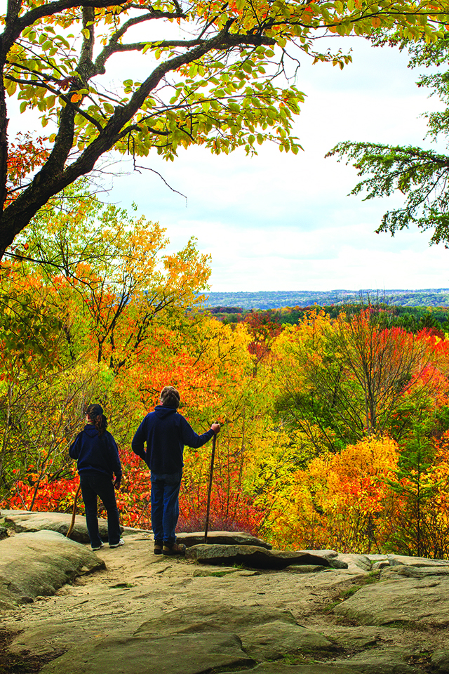
A striking view across miles of treetops is just one of the rewards of hiking Cuyahoga Valley National Park’s Ritchie Ledges. Tom Bilcze, co-organizer of Akron Area Hiking, has been traipsing across Summit County and the surrounding area for several years.
About five years ago, I started being active and I lost a lot of weight. I did it by bicycling originally, so I knew in the off-season I had to do something else. I volunteer for the Summit Metro Parks’ bike patrol, so I began going on their hiking sprees, and I discovered a lot of beautiful parks. Photography is my hobby, so I combine the two and go off hiking.
Ritchie Ledges has always been a very popular trail. There are a variety of reasons why: It is conveniently located between Akron and Cleveland, it has ample parking and part of the trail is fairly flat.
You have different options you can choose on that trail depending how adventurous you are. If you take the whole trail, it starts up on a plateau near a large picnic shelter.
Then you pass through some woods and have the option of descending through [and around] the ledges. You could stay on top if you’d like, but the most popular route is to follow the trail down. It’s a fairly gentle grade … and it’s very scenic and heavily wooded. Sandstone cliffs line the trail [and] these ledges and the trees that have grown through and along them dominate the views.
There are a lot of oaks and beech trees … so you get a show of colors. As you travel along the lower trail, there are stairs carved out of stone you can follow back up to the plateau. I believe they were a project of the Civilian Conservation Corps during the Depression.
If you stay [only] to the upper part of the ledges, you [can still] get some pretty spectacular views of the Cuyahoga Valley. In particular, on the southwest corner there is a very popular overlook [that is] stunning regardless of the weather or time of year. Being at one of the highest points in Summit County, it offers an unobstructed view of the Cuyahoga Valley … you can see for many, many miles. Since it’s facing west, it makes for spectacular sunset pictures. 701 Truxell Rd., Peninsula 44264, 330/657-2752, nps.gov/cuva
***
TRAIL MIX: Nearly 20 miles of the Ohio & Erie Canal Towpath Trail traverse the heart of Cuyahoga Valley National Park. Whether you want to explore it or one of the neighboring park systems, Akron Area Hiking co-organizer Tom Bilcze shares a few of his favorite hikes that can be found in the area.
Brandywine Gorge Trail at Brandywine Falls, Cuyahoga Valley National Park, 1.5-mile loop: “It’s a pretty dramatic waterfall,” says Bilcze. “Boardwalks take you down to several viewing stations.” The rushing falls are surrounded by fiery foliage come fall, and the loop hike that traverses the gorge offers a vivid view from creek level at its north end. nps.gov/cuva
Ohio & Erie Canal Towpath Trail, Boston to Peninsula, 5-mile round trip: “The most scenic part of that trail for hikers is between the little town of Boston and Peninsula,” Bilcze says. “The trail hugs the Cuyahoga River and … is also host to oak and beech trees. Because of this, you’ll get a great show of color in the fall.” nps.gov/cuva
Gorge Trail, Summit Metro Parks, 1.8-mile loop: “One of the last remaining large dams on the Cuyahoga River is in this park,” explains Bilcze. “It creates a beautiful lake that is really pretty in the fall with the trees surrounding it.” An advanced trail option leads hikers up through stunning rock-ledge formations, while beginners can stick to a path alongside the river. summitmetroparks.org
***

Lakeview Trail | Strouds Run State Park | 7-mile round-trip (trailhead to Dow Lake Dam and back)
Strouds Run State Park’s 2,606-acre hardwood forest offers 31 trails. Mimi Morrison, owner of Touch the Earth Adventures, has been roaming the area since her youth.
I grew up right here, so I’ve spent a lifetime of climbing these hills and paddling these waters. I’ve always said my DNA is in these hills. I love it here. Strouds Run State Park is a more than 2,000-acre forest, and there is a beautiful lake right in the center surrounded by trails. It is a very quiet, peaceful area.
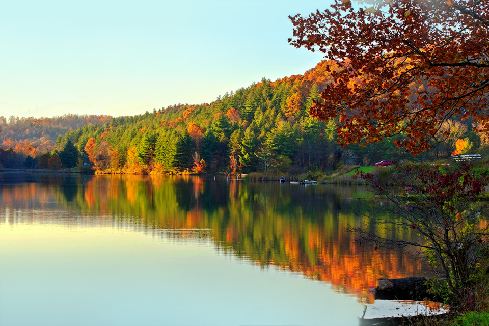
Lakeview Trail begins up by the swimming beach and it weaves in and out of inlets and coves, but you are in the woods. Oftentimes, you will have views across the water so that you see the color on the other side as well. There are maps available that show other [paths] that come off that one and make loops, so you are in a web of wonderful trails. There is an extremely active group here called Friends of Strouds Run, and they have worked endlessly and tirelessly on the [park] system here. They have created an oasis of hiking.
If you keep your eye out on the lake you might see some heron and some kingfisher. Those are both fun birds because the kingfisher will fly close to the shore a lot, and they are easy to spot because they are a little noisy. If it’s late in the day or an early morning hike and you are quiet, and you listen, you can hear the wood thrush. That’s just phenomenal.
When you are outside, you realize that you are a part of something so much bigger and so interconnected with everything. I think it’s nice, especially for families with kids, just to stop along the trail and sit down and look at what is around them.
It’s not just hiking down the trail to see some color. It’s stopping to see the little things that make the Earth work. If you stop and sit down and look in one little square foot, there is a universe right in that little square of dirt. 11661 State Park Rd., Athens 45701, 740/767-3570, parks.ohiodnr.gov/stroudsrun
***
TRAIL MIX: With 12 state park sites, more than a dozen nature preserves and sprawling state and national forests, hiking opportunities abound in southeast Ohio, particularly in the Hocking Hills region. Here are a few more fall-foliage trails that Touch the Earth Adventures owner Mimi Morrison suggests checking out.
Conkle’s Hollow, Upper Rim Trail, Hocking Hills State Park, 2.5-mile loop: “The true, tested trail of color in Hocking Hills, of course, is Conkle’s Hollow Rim Trail,” Morrison says. “You really do a climb to get up, but once you are up there you are standing on a very old ledge of sandstone, and it’s like looking out at an ocean of treetops in blazing color.” explorehockinghills.com
Airplane Rock Bridle Trail, Hocking State Forest, 2-mile round trip: “[This is] a gentle slope up to a rock outcropping that looks out over a valley of trees,” Morrison says. “They call it Airplane Rock because, if you stand in a certain place and look at it, it looks like the nose of an airplane coming out. You will see good color from up there.” explorehockinghills.com
Trace Trail, Strouds Run State Park, 2.4-mile round trip: “Trace Trail goes along through the forest and … in the second half it really opens up, so you are enveloped by the color around you,” Morrison says. She adds that this newer trail has been recently updated with historical signs so visitors can stop to read about the area’s geology and archaeology. parks.ohiodnr.gov/stroudsrun
***
Buzzardroost Rock Trail | Edge of Appalachia Preserve System | 4.4-mile round trip
Eleven distinct preserves are located within this 16,000-acre area of privately owned land, which has been under the care of the Ohio Chapter of the Nature Conservancy and the Cincinnati Museum Center for more than five decades. Since 1999, volunteer project leader Keith Zook has organized groups big and small to maintain and to help preserve the area’s unique ecosystems.
Last year, the staff at The Edge decided they wanted to relocate the Buzzardroost Rock trailhead. It was previously located across a busy road, so you’d park on the north side of state Route 125 and then walk a hundred yards. Then, you went into this low level … a wet area that was pretty boring as well. Then, suddenly you got to a spot where you had to climb more than 200 feet through a series of rapid switchbacks.
They had a different place identified where they could locate the trailhead, but it was a mile and a quarter away. My group of guys went and built bridges, we cleaned up spots … and then we connected the trail to the existing Buzzardroost Rock Trail.
The trail is now about 4.4 miles [round-trip] and the trailhead is now on the south side of state Route 125. We got rid of the boring slog, we got rid of the highway crossing and we got rid of the rapid switchback climb.
Now the hike starts off in a really pretty area, where you’ve got a little prairie. You go about 100 yards through that prairie and then you get into the woodland and for about a mile in that woodland, it’s just gorgeous … You are walking along a ridge — along the side of it actually. You’ve got water runoff down below, and you can see how all that water has carved out the rocks.
And then about a mile — a mile and a quarter into it — you get into another nice-sized prairie, [and] you climb up a little bit — the climb is just so much easier now. It’s just virtually no effort whatsoever.
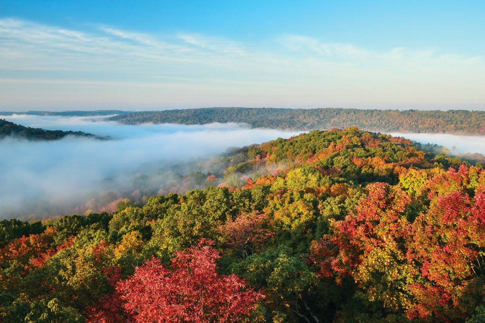
You get up to around 900 feet and then come out to the end of the trail, and it’s just a beautiful view of the Ohio Brush Creek valley. In the fall, it is filled with incredible colors. And [the spot] is appropriately named, because I don’t think I’ve ever been up there and haven’t seen buzzards. 4274 Waggoner Riffle Rd., West Union 45693, 937/544-2880, cincymuseum.org/nature
***
Trail Mix: Stay within the Edge of Appalachia Preserve System to enjoy more of the sights of the rugged southeast Ohio woodlands. The preserve's volunteer project leader Keith Zook gives us an overview of the system's three other trails.
Wilderness Trail, 2.5-mile loop: “This loop trail passes primarily through the woodlands [and] because of the wide variety of trees, there will be great scenery,” says Zook. Home to the largest diversity of plant species within the whole preserve — 744 recorded so far — the area’s chestnut oak, black gum, beech, tulip and sugar maple trees deliver vibrant fall colors. cincymuseum.org/nature | nature.org/edgeofappalachia
Lynx Prairie Trail, 1.4-mile loop: “Lynx is located behind a church and below a graveyard,” Zook says. “We relocated the trailhead … [and we built] about a quarter mile of new trail.” Roaming the three different loops along this updated trail, hikers uncover 10 vast prairie openings. Take a moment to be enveloped by the fall forest. cincymuseum.org/nature | nature.org/edgeofappalachia
Portman Trail, 1.6-mile round trip: Having just opened in 2014, the newest trail in the preserve will eventually connect the Edge of Appalachia Preserve System to the neighboring Shawnee State Forest for a lengthy 15-mile trail. “[This is] a pretty steady climb out of the Ohio Brush Creek valley,” Zook says. “You climb up the side of a hill and you get to another beautiful vista that will be just incredible this fall.” cincymuseum.org/nature | nature.org/edgeofappalachia
***
Wooded Walks
Here are other popular routes to check out at park systems throughout the state. To find more Ohio State Park and Preserve locations near you, visit parks.ohiodnr.gov.
CENTRAL
Columbus & Franklin County Metroparks: This system boasts more than 200 miles of trails within its 17 parks. Every fall, the 2-mile Sugarbush Trail in Blendon Woods provides a spectacular array of fall colors. At Chestnut Ridge, the 1-mile Ridge Trail reaches a pinnacle where hikers can enjoy views of both the Columbus skyline and the forested valley below. metroparks.net
NORTHEAST
Cleveland Metroparks: Cleveland’s Emerald Necklace offers 23,000 acres of parkland, streams and lakes among its 18 reservations. It’s home to 300 miles of trails, including favorites such as the 1.3-mile Fort Hill Loop Trail at the Rocky River Reservation and the 2.5-mile Hemlock Loop Trail at the Brecksville Reservation. clevelandmetroparks.com
Summit Metro Parks: Choose from 125 miles of hiking trails within 14 parks. The 1.8-mile Dogwood Trail in Sand Run Metro Park takes visitors through a wooded valley with plenty of shade and fall color, while the 1.2-mile Quarry Trail in Peninsula offers a connection to the Ohio & Erie Canal Towpath Trail. summitmetroparks.org
NORTHWEST
Metroparks of the Toledo Area: The Metroparks of the Toledo Area offers 150 miles of hiking trails within its 11,500 acres in and around the city. For spectacular fall views, rangers recommend the 8-mile Towpath Trail, which leads hikers along the Maumee River, as well as the 2.3-mile Red Trail at Wildwood Preserve Metropark, a winding path through a forest of oak, maple and cherry trees. metroparkstoledo.com
SOUTHEAST
Hocking Hills State Park: Hocking Hills State Park spans more than 2,300 acres with approximately 26 miles of hiking trails. Standout attractions include the half-mile Rock House Trail, which features a deep cave nestled within a cove of eastern hemlocks and oaks, as well as the always popular 1-mile Old Man’s Cave Trail that offers spectacular views of cliffs, waterfalls and oak and hickory trees. explorehockinghills.com
SOUTHWEST
Great Parks of Hamilton County: Hamilton County protects 16,600 acres of green space within its 17 parks, preserves and woods. The park system has more than 50 miles of walking and hiking trails, including the 1.1-mile Kingfisher Trail that winds through Winton Woods. The 0.7-mile Gorge Trail in Sharon Woods offers visitors a fiery corridor of fall color amid the sound of rushing water. greatparks.org
Related Articles

When Will Fall Color Peak in Ohio?
Peak autumn color is here across the state. It’s time to get out there and see it. READ MORE >>

Ohio State Parks for Fall Hikes
Get up close and personal with fall leaves, one step at a time. These four state parks have colorful jaunts for hikers of every skill level. READ MORE >>

50 Things to Do This Fall in Ohio
Autumn is our most beautiful season. From family fun and food festivals to scenic spots and spooky scares, here are great ways to embrace the crisp air and sunny days. READ MORE >>


