Hiking Every Mile of the Ohio & Erie Canal Towpath Trail
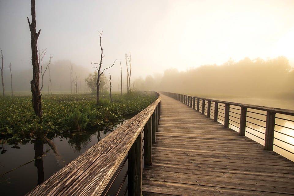
Walking the entirety of the 90-mile route that follows the path of the historic canal offers a look into the Ohio that was, the Ohio that is and our place in it.
June 2022
BY Jim Vickers | Photo by Anthony Boarman
June 2022
BY Jim Vickers | Photo by Anthony Boarman
It follows rivers and borders farm fields, cuts through the middle of cities and passes under enormous highway bridges. Beyond its natural beauty, the most alluring traits of the Ohio & Erie Canal Towpath Trail are its ubiquity and accessibility.
Ninety continuous miles of the trail are complete, from Canal Basin Park in Cleveland to state Route 800 in Tuscarawas County. Most of it traces the path that mules followed while pulling barges on the Ohio & Erie Canal. It spans multiple regional park systems and more than 50 trailheads, offering flat terrain that changes from hardened earth to crushed limestone to pavement.
Plus, those who want to hike the entire route really can. Few people can take on the 1,444-mile Buckeye Trail, but with planning and persistence, you can experience every mile of the Ohio & Erie Canal Towpath Trail. We did just that over the course of a year, under blues skies and gray ones, among the buds of spring and the leaves of fall. Here’s what we saw along the way, and what you can, too.
Canal Lands Park to John Glenn Grove (18.15 miles)
The southern end of the Ohio & Erie Canal Towpath Trail is currently a patch of crushed limestone along state Route 800. It won’t always be that way though. In February 2022, Tuscarawas County commissioners hired consultants to design a 2-mile extension reaching south to Dover Dam, part of the trail’s proposed 101-mile route between Cleveland and New Philadelphia.
Until then, the Canal Lands Park trailhead, a 2.75-mile walk north from state Route 800, is the best place to begin when exploring the Towpath Trail’s southernmost portion. It’s where we start in early May. First, we hike 3 miles north to Bolivar and the site of Ohio’s only Revolutionary War fort. A month later, on a drizzly summer afternoon, we head south to the trail’s end.
By the end of August our thoughts turn to walking more of the Towpath Trail — all of it, in fact. The 90 miles seem a little daunting but doable, plus we had covered almost 6 miles of it already. With a plan to hike in all seasons, a May 1 goal seems reasonable.
So, on Labor Day, we head to the McDonnell trailhead near Bolivar, catching sight of inner tubers on the Tuscarawas River as we cross the bridge that connects the Tuscarawas County and Stark County portions of the trail.
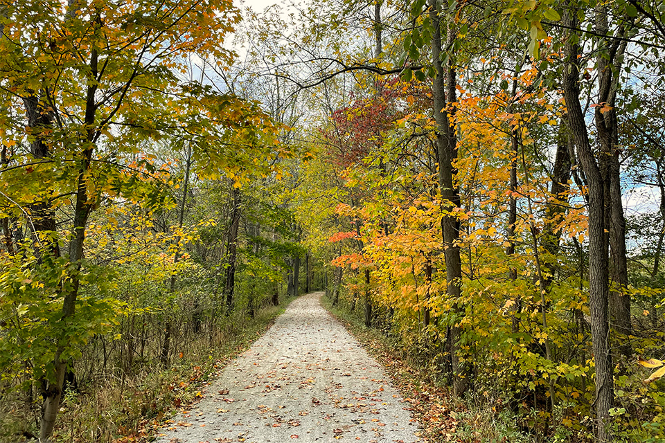
We walk north to John Glenn Grove in Massillon over a series of a few different hikes (and cover the short portion between Fort Laurens and the McDonnell trailhead in late fall). This southernmost part of the trail reflects the area’s rural nature, with thick woods lining the path and even a farm field bordering it for a stretch.
When we reach John Glenn Grove, we are treated to one of the many discoveries made during our year on the trail: a sculpture of the Ohio native and first American to orbit the Earth. Artist Indigo Loveland’s inspiring piece depicts Glenn from the waist up and outfitted in his Friendship 7 spacesuit, his left arm outstretched, hand open and eyes focused on three stars within his grasp.
John Glenn Grove to St. Helena Heritage Park (13.2 miles)
The day after Christmas brings a sunny and unseasonably warm morning, so we walk north from John Glenn Grove to downtown Massillon. (Just beyond, an ongoing levee-restoration project by the U.S. Army Corps of Engineers creates a temporary, 1.4-mile break in the trail.)
This 4-mile stretch is where the Towpath Trail’s wooded southern portion first gives way to city. The path emerges from trees to run along state Route 21. Down to the left, a wide swath of the Tuscarawas River drifts past, and to the right, a safe distance away, vehicles rush by on the highway.
At the intersection with Walnut Road, the trail makes a left, across the river and through part of Massillon’s Oak Knoll Park. Here, it passes by the “Oldest Iron Bridge in Ohio, 1859, Built in Massillon,” as noted on a small metal sign. (The bridge originally stood in Alliance but was moved and displayed in the city park in 1899.) This and other finds along the trail offer insight into local heritage. One of the best places to see this merger of past and present is in Canal Fulton.
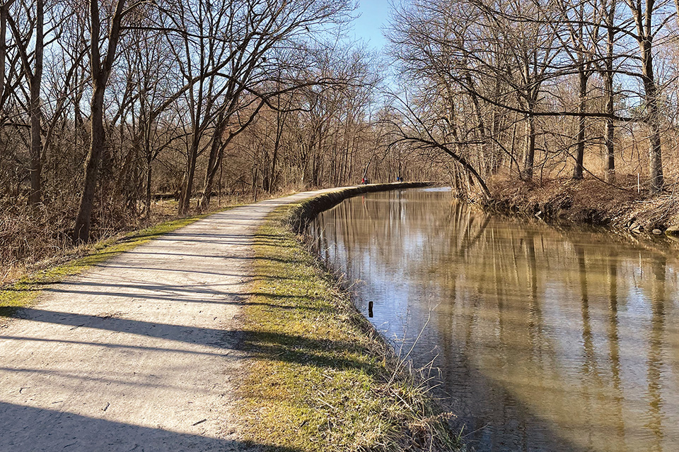
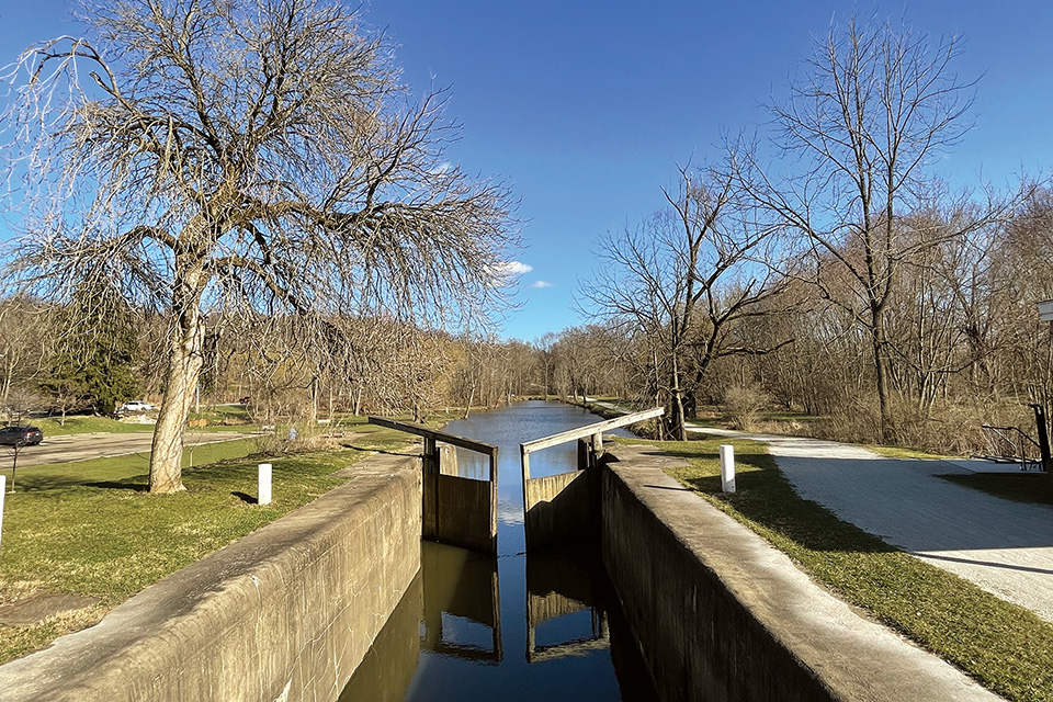
On a clear and crisp day in mid-March, we walk north from the Lake Avenue trailhead. After first passing under bridges, the trail runs through quiet sections of trees. Several miles in, Lock 4 comes up on the right. But rather than a crumbling ruin as most of the canal locks are today, it holds water, illustrating how barges were raised or lowered to make their way on to the next portion of the staircase-like waterway.
A bit farther and we pass the dry dock where the St. Helena III is stored. It’s only then that we learn about the authentically built canal boat that offers rides on this original portion of the canal each summer. It also explains an unusual sign we spotted near Lock 4 — a black, upturned triangle with these words: “Trail users must yield to canal horses.”
St. Helena Heritage Park to Wilbeth Road (16.1 miles)
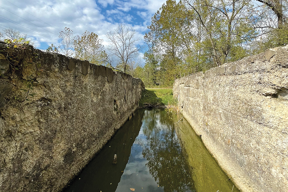
Traveling north from Canal Fulton’s St. Helena Heritage Park, the Towpath Trail heads past an ice cream stand and into the woods toward the Summit County line. The walk is easy on a late-April day and provides an opportunity to take a closer look at a large lock ruin, one of many that dot the length of the canal corridor.
Locks were the cornerstone of the Ohio & Erie Canal, which opened between Cleveland and Akron in 1825 and ran to the southern Ohio town of Portsmouth by 1832. It was dug by laborers, who used picks and shovels to create the 4-foot-deep waterway. The Towpath Trail seems flat, but the canal varied in elevation as it followed the terrain. It climbed gradually from New Philadelphia to its highest point in Akron — known as the Portage Summit — then it dropped almost 400 feet as it passed through the Cuyahoga Valley and on to Lake Erie. Locks were numbered sequentially both north and south from the Portage Summit, with 44 located between Akron and Cleveland alone.
Near Vanderhoof Road, the Towpath Trail passes through property owned by the glass company PPG, which has long had a presence here. Because the path of the Ohio & Erie Canal through Barberton had been lost over the years, this easement allows for a trail connection although it veers from the original route. (This happens periodically along the trail, including where it passes through Akron and north of Harvard Avenue in Cleveland.)
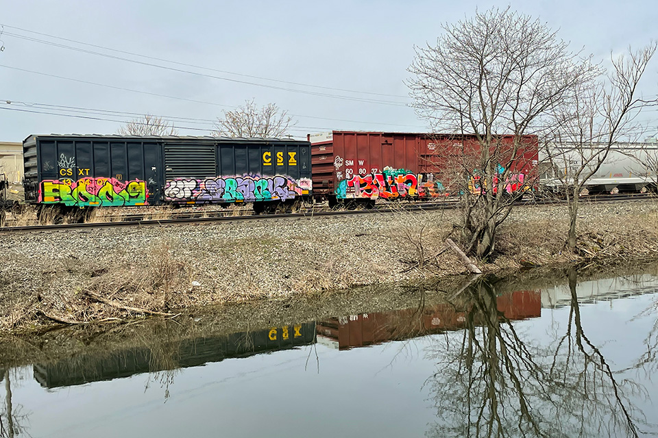
Barberton became known as the Magic City in the 1890s due to a population boom fueled by industry. That growth followed the rise of railroads that, along with the Great Flood of 1913, brought an end to the Ohio & Erie Canal.
Places where industry intersects with the trail are more plentiful the farther north one goes. It is a reminder that the canal was an economic corridor long before it was a recreational one. It also highlights the complexity of linking the trail through the industrialized parts of northeast Ohio and why the work has been ongoing since the 1990s.
Wilbeth Road to Botzum (11.15 miles)
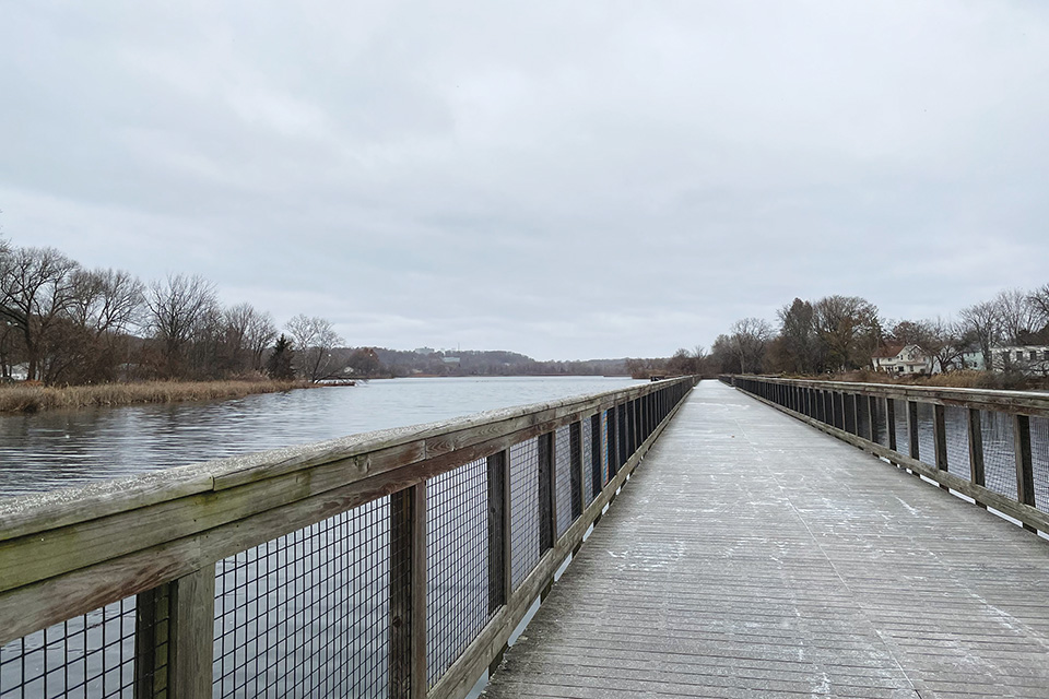
We encounter the slate-gray expanse of Summit Lake on a late November day when flurries fill the air. The 100-acre body of water, which sits just south of the highway ramps and concrete of downtown Akron, seems out of place, but the lake has been here since the last glacier passed through.
A portion of the Towpath Trail along the lake crosses a floating boardwalk, a concept that surprisingly was in practice when mules pulled canal barges across a similar setup. The lake suffered from industrial pollution at the dawn of the 20th century, but it has since been cleaned up to become a place for recreation and wildlife watching
As we enter downtown, the trail threads itself between Akron Children’s Hospital and Lock 3 Park. It’s also where we detour off for a beer and snacks at Akronym Brewing — the incentive that brought us out to hike on this wintry day.
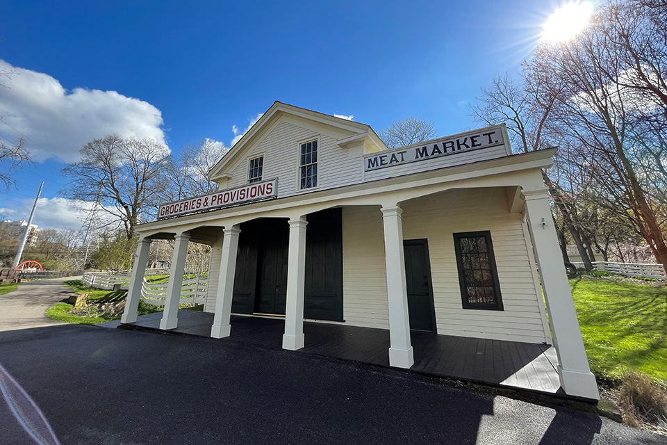
We cover the northern half of the stretch during the last half of April, months later. The path out of downtown weaves under overpasses, down an incline and across a busy two-lane road. Then, suddenly, the city is behind you, and you’re standing in front of the historic Mustill Store. The store and the Greek Revival house next to it date to the 1840s and sit next to Lock 15. Three generations of the Mustill family worked the grocery, which served farmers, neighbors and those who traveled the canal.
Heading farther north, the trail takes hikers by the Big Bend trailhead, named after a spot along the Cuyahoga River. A mile farther, the statue of an indigenous man carrying a canoe stands where the trail briefly passes by Merriman Road. It marks the northern end of the Portage Path, an 8-mile route Native Americans once used to travel between the Tuscarawas and Cuyahoga rivers. A second statue stands at the opposite end, and bronze arrowhead sculptures mark the route, reminding modern travelers of those who followed the same path centuries ago.
Botzum to Station Road Bridge (13.4 miles)
Many hikers log their first miles on the Towpath Trail within the borders of the roughly 33,000-acre Cuyahoga Valley National Park. The crushed-limestone pathway serves as the park’s central artery, and on a sunny summer afternoon it is usually filled with bicyclists, runners, hikers and families out for a stroll.
We walk a large portion of it in the fall, when crowds have waned a bit, particularly on gray-sky afternoons when brown leaves already skitter across the ground and the woods have started to take on the gaunt look of winter.
If one can hike only a small portion of the Towpath Trail, Cuyahoga Valley National Park is where to do it. Long wooded stretches make for excellent places to have long conversations or enjoy long silences, while also getting a look at the Cuyahoga Valley as it existed during the canal era and before.
Heading north from the Botzum trailhead, Beaver Marsh is the first landmark that hikers encounter. It is teeming with life in the summer and a large wooden boardwalk with built-in benches provides an inviting place to take it all in.
Beyond that, the town of Peninsula offers the chance to take a close look at Lock 29 or stop into the Trail Mix park store, while farther north — across a short, boardwalk-covered portion of the route that winds through a place known as Stumpy Basin and on past the towering supports of both the Ohio Turnpike and Interstate 271 bridges — sits the historic village of Boston.
Boston is considered the heart of the park and where the Conservancy for Cuyahoga Valley National Park built a new visitor center. (The historic Boston Store down the street is now a market serving travelers.) The Boston Mill Visitor Center is a must for those who want to fully understand the geography and complexity of the region through which the Towpath Trail runs. The visitor center offers a birds-eye perspective of the Cuyahoga Valley by way of a tabletop map and is a good spot for stopping in to learn more about the history of the area and how the park came to be.
Station Road Bridge to Bacci Park Aqueduct (8.1 miles)
Brecksville’s Station Road Bridge was built in 1881, just after train tracks reached the area. Today, the Cuyahoga Valley Scenic Railroad chugs the length of the park for sightseeing excursions and makes stops at the depot next to the historic span.
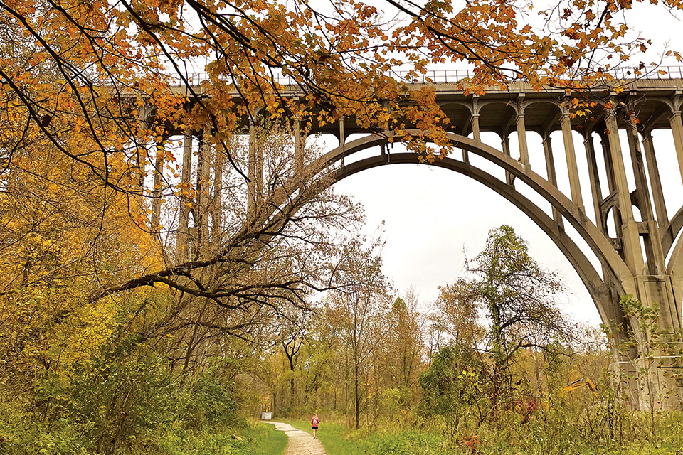
On a fall day, we walk north from Station Road Bridge, taking in views of the towering Brecksville-Northfield High-Level Bridge that connects Cuyahoga and Summit counties, and follow the curve of the Towpath Trail as it emerges from the woods and runs parallel to Canal Road. Soon after, the brick, Federal-style Frazee House appears.
The Frazee family built the house in 1827, after first living in a cabin on the property. They were farmers, and their land’s proximity to the canal not only brought produce buyers to them, but also provided access to markets far beyond the region. Today, tours of the home offer a glimpse of frontier living in the Cuyahoga Valley. (A footbridge across the canal provides trail access to the home.)
A couple miles north sits the Canal Exploration Center, where we are greeted by a life-size statue of a mule like the ones that pulled canal boats up and down the waterway. Although horses are often used today during excursion canal-boat rides, mules were hardier and could better tolerate the long days of pulling.
The Canal Exploration Center is housed in a historic-but-updated white structure once known as Hell’s Half Acre, a tavern and inn that served canal-era travelers. Today, it houses a small museum staffed by the National Park Service. Lock 38, located immediately along the trail outside the center’s front door, is another working lock that illustrates the principle at the heart of canal travel.
Two more miles north, Lock 39 appears before the trail passes beneath Rockside Road in Valley View and beyond the borders of the national park. It marks a distinct shift, passing by restaurants and a multiplex movie theater before being dwarfed by the enormity of the Interstate 480 bridge just south of Cleveland. Beyond that, two suspension bridges carry hikers and bicyclists over a pair of busy roads, allowing safe crossing above the hum of traffic.
Bacci Park Aqueduct to Canal Basin Park (9.3 miles)
Some years, the first day of summer arrives before winter ever leaves. On a Saturday in early March, warm temperatures and blue skies show up and convince us that, yes, today is the day to tackle the more than 9-mile leg of the Towpath Trail that runs from the Bacci Park Aqueduct in Cuyahoga Heights to the trail’s end at Canal Basin Park in Cleveland.
It is a fitting finale, and one that was only recently made possible. In June 2021, local leaders celebrated the completion of the last links along Cuyahoga County’s paved, 11-mile portion of the trail during a ribbon cutting at Camp Cleveland, a former Civil War training site that looks out toward downtown.
As we head north from the Bacci Park Aqueduct, the trail is paved and easy to navigate, crossing under a large train trestle and past former industrial areas. Beyond Harvard Avenue there is a brief bit of sidewalk hiking, but the route is clearly marked, and soon the trail cuts between the big-box retailers of Steelyard Commons and the hulking ArcelorMittal steel plant.
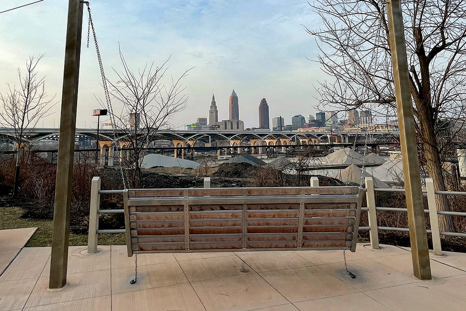
These last miles are some of the most unusual and exhilarating of our entire trek: As the trail rises to meet the Tremont neighborhood, a walkway invites us to step out and take in a view of the steel mill. Around a curve is Camp Cleveland and the entirety of the Cleveland skyline. We watch for a moment as a freight train thunders along the tracks far below the cars zipping by downtown on the elevated Innerbelt Bridge.
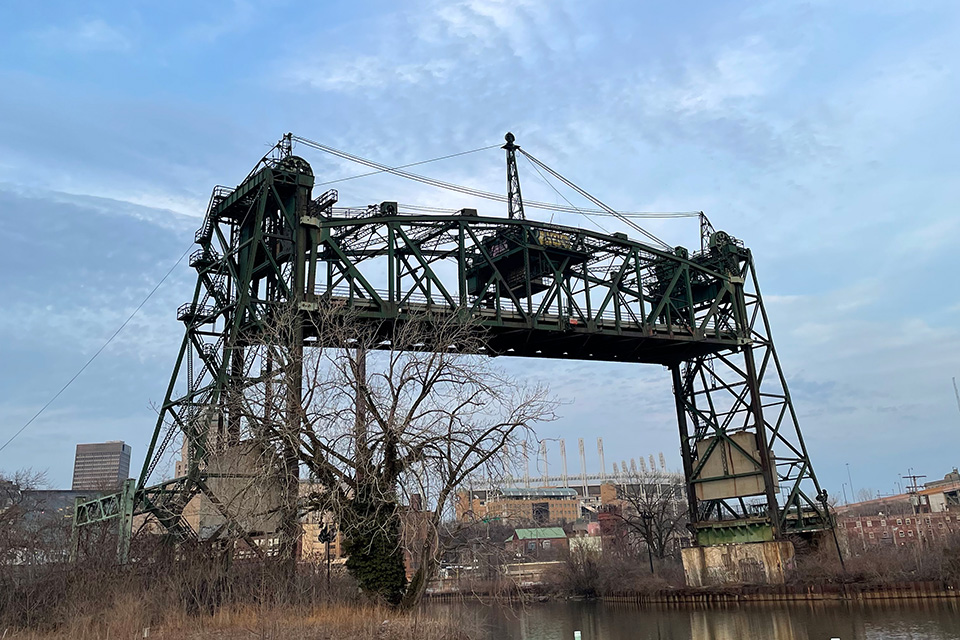
As we head down the hill over the last few miles, we slow down and take in the city, as we pass along the Cuyahoga River and the huge bridges that stand along it. The sun is setting as we walk across one last bridge and toward Canal Basin Park. The lights of the skyscrapers become more apparent. With each step, we soak in the warm air and this modern city, one with roots that stretch back to a 4-foot-deep canal that was dug by hand.
For more information about the Ohio & Erie Canal, visit ohioanderiecanalway.com.
Related Articles

Ohio State Parks for Fall Hikes
Get up close and personal with fall leaves, one step at a time. These four state parks have colorful jaunts for hikers of every skill level. READ MORE >>
Explore Native American History at 4 Ohio Parks
Walk trails that provide beautiful scenery as well as insight into the lives of those who lived here long before we did. READ MORE >>
.jpg?sfvrsn=11d8be38_6&w=960&auto=compress%2cformat)
Outdoor Adventures in West Virginia
Spring in the Mountain State offers a multitude of ways to enjoy the outdoors, from hiking and rafting to fishing and bird-watching. READ MORE >>


